|
|
 |
 |
 |
 |
|
Handheld GPS
Comparison |
04th May 2003
|
|
|
Article by
Dave Burrows
There are so many handheld GPS Receivers out on
the market, it's starting to become very difficult to find the wood from the
threes. Most of the receivers are of similar specification, but some can
be quite different in price, so we've tried to bring together the most popular
handheld GPS Receivers and compare the complete manufacturer specifications.
You can also read the review on any of these GPS Receivers if a review has been
written by clicking on the Read Review link under each GPS Receiver. |
| |
 |
 |
 |
 |
| |
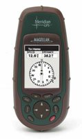
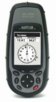
Magellan
Meridian GPS |
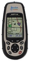
Magellan
Meridian Colour |
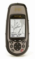
Magellan
Meridian Gold |
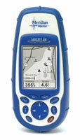
Magellan
Meridian Marine |
| Review |
Read
Review |
Read Review |
Read
Review |
Read Review |
| Basemap |
2mb cities/highways |
16mb cities/highways |
16mb cities/highways |
16mb cities/highways |
| Number of Screens |
7 |
9 |
7 |
7 |
| Position Update |
1 sec |
1 sec |
1 sec |
1 sec |
| TTFF Cold |
<2 mins |
<2 mins |
<2 mins |
<2 mins |
| TTFF Warm |
<1 min |
<1 min |
<1 min |
<1 min |
| TTFF Hot |
15 secs |
15 secs |
15 secs |
15 secs |
| Max Velocity |
951 mph |
951 mph |
951 mph |
951 mph |
| Weight |
8 oz / 227gm |
8 oz / 227gm |
8 oz / 227gm |
8 oz / 227gm |
| Display Size
|
2.2in x 1.75in |
2.2in x 1.55in |
2.2in x 1.75in |
2.2in x 1.75in |
| Display Resolution |
120 x 160 |
120 x 160 |
120 x 160 |
120 x 160 |
| Colour Display ? |
Grayscale |
High-Colour |
Grayscale |
Grayscale |
| Backlit Display |
Yes |
Yes |
Yes |
Yes |
| Antenna |
Quad Helix |
Quad Helix |
Quad Helix |
Quad Helix |
| Horizontal Accuracy |
<7 m |
<7 m |
<7 m |
<7 m |
| Horizontal Accuracy WAAS / EGNOS |
<3 m |
<3 m |
<3 m |
<3 m |
| Battery Type |
AA |
AA |
AA |
AA |
| Battery Life (hours) |
14 |
14 |
14 |
14 |
| Additional Memory |
SD Cards |
SD Cards |
Built In |
Built In |
| Additional Maps |
MapSend |
MapSend |
MapSend |
MapSend |
| Waterproof |
Yes |
Yes |
Yes |
Yes |
| Min Operating Temp |
-10C / 14F |
-10C / 14F |
-10C / 14F |
-10C / 14F |
| Max Operating Temp |
60C / 140F |
60C / 140F |
60C / 140F |
60C / 140F |
| Max Operating Alt |
60,000 ft / 18,288 m |
60,000 ft / 18,288 m |
60,000 ft / 18,288 m |
60,000 ft / 18,288 m |
| Waypoints |
500 |
500 |
500 |
500 |
| Routes |
20 |
20 |
20 |
20 |
| Trackpoints |
2000 |
2000 |
2000 |
2000 |
| Datums |
76 |
76 |
76 |
76 |
| DGPS/WAAS/EGNOS |
Yes |
Yes |
Yes |
Yes |
| Electronic Compass |
Yes |
Yes |
Yes |
Yes |
| Barometric Altimeter |
n/a |
n/a |
n/a |
n/a |
| Hunting/Fishing Calc |
Yes |
Yes |
Yes |
Yes |
| Celestial Information |
Yes |
Yes |
Yes |
Yes |
| Interface |
9 pin Serial |
9 pin Serial |
9 pin Serial |
9 pin Serial |
| |
|
|
|
|
| |
|
|
|
|
| |
|
|
|
|
| |
 |
 |
 |
 |
| |
Magellan
Meridian Platinum |
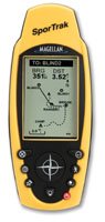
Magellan
SporTrak |
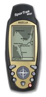
Magellan
SporTrak Map |
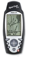
Magellan
SporTrak Pro |
| Review |
Read Review |
Coming Soon |
Read
Review |
Coming Soon |
| Basemap |
16mb cities/highways |
Cities Locations POI's |
2mb cities/highways |
9mb cities/highways |
| Number of Screens |
7 |
9 |
7 |
7 |
| Position Update |
1 sec |
1 sec |
1 sec |
1 sec |
| TTFF Cold |
<2 mins |
<2 mins |
<2 mins |
<2 mins |
| TTFF Warm |
<1 min |
<1 min |
<1 min |
<1 min |
| TTFF Hot |
15 secs |
15 secs |
<15 secs |
<15 secs |
| Max Velocity |
951 mph |
951 mph |
951 mph |
951 mph |
| Weight |
8 oz / 227gm |
8 oz / 227gm |
6.1 oz |
6.1 oz |
| Display Size
|
2.2in x 1.75in |
2.3in x 1.4in |
2.2in x 1.75in |
2.3in x 1.4in |
| Display Resolution |
120 x 160 |
160 x 104 |
160 x 104 |
160 x 104 |
| Colour Display ? |
Grayscale |
Grayscale |
Grayscale |
Grayscale |
| Backlit Display |
Yes |
Yes |
Yes |
Yes |
| Antenna |
Quad Helix |
Quad Helix |
Quad Helix |
Quad Helix |
| Horizontal Accuracy |
<7 m |
<7 m |
<7 m |
<7 m |
| Horizontal Accuracy WAAS / EGNOS |
<3 m |
<3 m |
<3 m |
<3 m |
| Battery Type |
AA |
AA |
AA |
AA |
| Battery Life (hours) |
14 |
14 |
14 |
14 |
| Additional Memory |
SD Cards |
Built In |
Built In |
Built In |
| Additional Maps |
MapSend |
n/a |
MapSend |
MapSend |
| Waterproof |
Yes |
Yes |
Yes |
Yes |
| Min Operating Temp |
-10C / 14F |
-10C / 14F |
-10C / 14F |
-10C / 14F |
| Max Operating Temp |
60C / 140F |
60C / 140F |
60C / 140F |
60C / 140F |
| Max Operating Alt |
60,000 ft / 18,288 m |
No Info from Magellan |
60,000 ft / 18,288 m |
60,000 ft / 18,288 m |
| Waypoints |
500 |
500 |
500 |
500 |
| Routes |
20 |
20 |
20 |
20 |
| Trackpoints |
2000 |
2000 |
2000 |
2000 |
| Datums |
76 |
76 |
76 |
76 |
| DGPS/WAAS/EGNOS |
Yes |
Yes |
Yes |
Yes |
| Electronic Compass |
Yes |
Yes |
Yes |
Yes |
| Barometric Altimeter |
Yes |
n/a |
n/a |
n/a |
| Hunting/Fishing Calc |
Yes |
Yes |
Yes |
Yes |
| Celestial Information |
Yes |
Yes |
Yes |
Yes |
| Interface |
9 pin Serial |
9 pin Serial |
9 pin Serial |
9 pin Serial |
| |
|
|
|
|
| |
|
|
|
|
| |
|
|
|
|
| |
 |
 |
 |
 |
| |
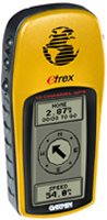
Garmin
eTrex |
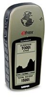
Garmin
eTrex Summit |
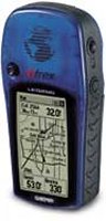
Garmin
eTrex Legend |
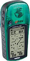
Garmin
Venture |
| Review |
Read Review |
Coming Soon |
Coming Soon |
Coming Soon |
| Basemap |
n/a |
8mb |
1mb Cities / Highways |
24mb Cities / Highways |
| Number of Screens |
n/a |
n/a |
n/a |
n/a |
| Position Update |
1 sec |
1 sec |
1 sec |
1 sec |
| TTFF Cold |
5 mins |
5 mins |
5 mins |
5 mins |
| TTFF Warm |
45 secs |
45 secs |
45 secs |
45 secs |
| TTFF Hot |
15 secs |
15 secs |
15 secs |
15 secs |
| Max Velocity |
n/a |
n/a |
n/a |
n/a |
| Weight |
5.3 oz |
5.3 oz |
5.3 oz |
5.3 oz |
| Display Size
|
2.1in x 1.1in |
2.1in x 1.1in |
2.1in x 1.1in |
2.1in x 1.1in |
| Display Resolution |
128 x 64 |
128 x 64 |
288 x 160 |
288 x 160 |
| Colour Display ? |
Grayscale |
Grayscale |
Grayscale |
Grayscale |
| Backlit Display |
Yes |
Yes |
Yes |
Yes |
| Antenna |
Patch |
Patch |
Patch |
Patch |
| Horizontal Accuracy |
15 m |
15 m |
15 m |
15 m |
| Horizontal Accuracy WAAS / EGNOS |
n/a |
n/a |
3-5 m |
3-5 m |
| Battery Type |
AA |
AA |
AA |
AA |
| Battery Life (hours) |
22 |
22 |
18 |
20 |
| Additional Memory |
None |
None |
8mb Built In |
1mb Built In |
| Additional Maps |
n/a |
MapSource |
MapSource |
MapSource |
| Waterproof |
Yes |
Yes |
Yes |
Yes |
| Min Operating Temp |
-15C / 5F |
-15C / 5F |
-15C / 5F |
-15C / 5F |
| Max Operating Temp |
70C / 158F |
70C / 158F |
70C / 158F |
70C / 158F |
| Max Operating Alt |
n/a |
n/a |
n/a |
n/a |
| Waypoints |
500 |
500 |
500 |
500 |
| Routes |
1 |
20 |
20 |
20 |
| Trackpoints |
1536 |
3000 |
2048 |
2048 |
| Datums |
n/a |
n/a |
n/a |
n/a |
| DGPS/WAAS/EGNOS |
No |
No |
Yes |
Yes |
| Electronic Compass |
n/a |
Yes |
n/a |
Yes |
| Barometric Altimeter |
n/a |
Yes |
n/a |
Yes |
| Hunting/Fishing Calc |
n/a |
n/a |
Yes |
Yes |
| Celestial Information |
n/a |
n/a |
Yes |
Yes |
| Interface |
9 pin Serial |
9 pin Serial |
9 pin Serial |
9 pin Serial |
| |
|
|
|
|
| |
|
|
|
|
| |
|
|
|
|
| |
 |
 |
 |
 |
| |
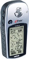
Garmin
Vista |
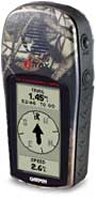
Garmin
Camo |
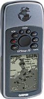
Garmin
GPSMap76 |
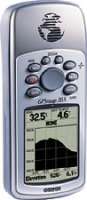
Garmin
GPSMap76S |
| Review |
Read Review |
Coming Soon |
Read Review |
Coming Soon |
| Basemap |
24mb Cities/Highways |
n/a |
8mb Cities/Highways |
24mb Cities/Highways |
| Number of Screens |
n/a |
n/a |
n/a |
n/a |
| Position Update |
1 sec |
1 sec |
1 sec |
1 sec |
| TTFF Cold |
5 mins |
5 mins |
5 mins |
5 mins |
| TTFF Warm |
45 secs |
45 secs |
45 secs |
45 secs |
| TTFF Hot |
15 secs |
15 secs |
15 secs |
15 secs |
| Max Velocity |
n/a |
n/a |
n/a |
n/a |
| Weight |
5.3 oz |
5.3 oz |
7.7 oz |
7.7 oz |
| Display Size
|
2.1in x 1.1in |
2.1in x 1.1in |
2.2in x 1.6in |
2.2in x 1.6in |
| Display Resolution |
288 x 160 |
128 x 64 |
240 x 180 |
240 x 180 |
| Colour Display ? |
Grayscale |
Grayscale |
Grayscale |
Grayscale |
| Backlit Display |
Yes |
Yes |
Yes |
Yes |
| Antenna |
Patch |
Patch |
Quad Helix |
Quad Helix |
| Horizontal Accuracy |
15 m |
15 m |
15 m |
15 m |
| Horizontal Accuracy WAAS / EGNOS |
3-5 m |
n/a |
3-5 m |
3-5 m |
| Battery Type |
AA |
AA |
AA |
AA |
| Battery Life (hours) |
12 |
22 |
16 |
10 |
| Additional Memory |
n/a |
n/a |
n/a |
n/a |
| Additional Maps |
MapSource |
n/a |
MapSource |
MapSource |
| Waterproof |
Yes |
Yes |
Yes |
Yes |
| Min Operating Temp |
-15C / 5F |
-15C / 5F |
-15C / 5F |
-15C / 5F |
| Max Operating Temp |
70C / 158F |
70C / 158F |
70C / 158F |
70C / 158F |
| Max Operating Alt |
n/a |
n/a |
n/a |
n/a |
| Waypoints |
500 |
500 |
500 |
500 |
| Routes |
20 |
1 |
50 |
50 |
| Trackpoints |
3000 |
2000 |
2048 |
5000 |
| Datums |
n/a |
n/a |
n/a |
n/a |
| DGPS/WAAS/EGNOS |
Yes |
n/a |
Yes |
Yes |
| Electronic Compass |
Yes |
n/a |
n/a |
Yes |
| Barometric Altimeter |
Yes |
n/a |
n/a |
Yes |
| Hunting/Fishing Calc |
Yes |
Yes |
Yes |
Yes |
| Celestial Information |
Yes |
Yes |
Yes |
Yes |
| Interface |
9 pin Serial |
9 pin Serial |
9 pin Serial |
9 pin Serial |
| |
|
|
|
|
| |
|
|
|
|
| |
|
|
|
|
| |
 |
 |
|
|
| |
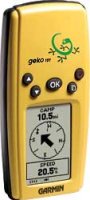
Garmin
Geko 101 |
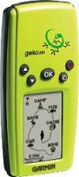
Garmin
Geko 201 |
|
|
| Review |
Coming Soon |
Coming Soon |
|
|
| Basemap |
|
|
|
|
| Number of Screens |
n/a |
n/a |
|
|
| Position Update |
1 sec |
1 sec |
|
|
| TTFF Cold |
5 mins |
5 mins |
|
|
| TTFF Warm |
45 secs |
45 secs |
|
|
| TTFF Hot |
15 secs |
15 secs |
|
|
| Max Velocity |
n/a |
n/a |
|
|
| Weight |
3.1 oz |
3.1 oz |
|
|
| Display Size
|
0.92in x 1.44in |
|
|
|
| Display Resolution |
64 x 100 |
64 x 100 |
|
|
| Colour Display ? |
Grayscale |
Grayscale |
|
|
| Backlit Display |
Yes |
Yes |
|
|
| Antenna |
Patch |
Patch |
|
|
| Horizontal Accuracy |
15 m |
15 m |
|
|
| Horizontal Accuracy WAAS / EGNOS |
n/a |
3-5 m |
|
|
| Battery Type |
AAA |
AAA |
|
|
| Battery Life (hours) |
12 |
12 |
|
|
| Additional Memory |
n/a |
n/a |
|
|
| Additional Maps |
n/a |
n/a |
|
|
| Waterproof |
Yes |
Yes |
|
|
| Min Operating Temp |
-15C / 5F |
-15C / 5F |
|
|
| Max Operating Temp |
70C / 158F |
70C / 158F |
|
|
| Max Operating Alt |
n/a |
n/a |
|
|
| Waypoints |
250 |
500 |
|
|
| Routes |
n/a |
20 |
|
|
| Trackpoints |
3000 |
10000 |
|
|
| Datums |
18 |
100 |
|
|
| DGPS/WAAS/EGNOS |
No |
Yes |
|
|
| Electronic Compass |
n/a |
n/a |
|
|
| Barometric Altimeter |
n/a |
n/a |
|
|
| Hunting/Fishing Calc |
n/a |
n/a |
|
|
| Celestial Information |
n/a |
n/a |
|
|
| Interface |
n/a |
9 pin Serial |
|
|
| |
|
|
|
|
|
GPS
Hardware TTFF (Time To First Fix)
| |
Cold
Test 1 |
Cold
Test 2 |
Cold
Test 3 |
Cold
Test 4 |
Cold
Test 5 |
Cold
Test
Average |
Warm
Test |
Hot
Test |
| CoPilot CF |
1m 22s |
1m 8s |
56s |
1m 17s |
54s |
1m 07s |
52s |
16s |
| Emtac
Sleeve/CoPilot |
40s |
37s |
42s |
37s |
46s |
40.4s |
10s |
9s |
| Emtac/Socket BT
GPS |
47s |
53s |
42s |
36s |
38s |
43.2s |
10s |
17s |
| Garmin
eTrex |
39s |
44s |
40s |
41s |
43s |
41.4s |
8s |
N/A |
| Garmin
eTrex Summit |
38s |
41s |
45s |
39s |
42s |
41.0s |
8s |
N/A |
| Garmin eTrex Vista |
37s |
57s |
32s |
35s |
38s |
39.8s |
17s |
N/A |
| Garmin GPSMap76 |
42s |
34s |
23s |
56s |
32s |
37.4s |
12s |
N/A |
| Garmin GPSMap76S |
32s |
53s |
32s |
39s |
36s |
38.4s |
11s |
N/A |
| Garmin
Geko 101 |
1m 37s |
45s |
38s |
44s |
41s |
53s |
15s |
13 |
| Garmin
Geko 201 |
34s |
45s |
38s |
43s |
40s |
40s |
19s |
10 |
| HaiCom 302 CF |
50s |
33s |
1m 25s |
36s |
1m 25s |
57.8s |
23s |
10s |
| HaiCom 303 MMF |
42s |
1m 05 s |
41s |
1m 02 s |
1m 18s |
57.6s |
36s |
3s |
| Holux GM-210 |
42s |
38s |
35s |
37s |
42s |
38.8s |
30s |
4s |
| Holux GM-270 |
54s |
1m 07 s |
1m 03s |
50s |
1m 12s |
61.2s |
39s |
4s |
| Holux GM-270U |
46s |
49s |
42s |
1m 01 s |
49s |
49.4s |
35s |
3s |
| Holux GR-230 |
1m 02s |
55s |
50s |
49s |
52s |
53.6s |
39s |
5s |
| LeadTek 9531
/ 9532 |
29s |
37s |
39s |
41s |
43s |
37.8s |
9s |
5s |
|
Magellan Meridian Range of GPS |
38s |
53s |
43s |
33s |
35s |
40.4s |
18s |
15s |
| Magellan SporTrak
Range of GPS |
37s |
47s |
46s |
41s |
41s |
42.4s |
19s |
16s |
| Navman 3000
(ROM 2.0.0) |
49s |
52s |
1m 33s |
3m 23s |
8m 5s |
2m 56s |
20s |
11s |
| Navman 3400/3420
(ROM 2.1.2) |
1m 33s |
2m 30s |
1m 32s |
52s |
1m 17s |
1m 32.8s |
20s |
12s |
| Navman 3450
(ROM 2.1.2) |
57s |
50s |
1m 09s |
48s |
1m 0s |
56.8s |
20s |
11s |
| Navman
4400 |
53s |
1m 03s |
1m 19s |
54s |
53s |
1m 00.4s |
0s |
0s |
| Pretec Compact CF |
1m 28s |
2m 47s |
57s |
45s |
1m 2s |
1m 23s |
1m 16s |
12s |
| Pretec Compact LP
CF |
3m 48s |
5m 32s |
4m 59s |
1m 53s |
4m 02s |
4m 04s |
52s |
33s |
| Rikaline X5 |
41s |
41s |
34s |
41s |
42s |
39.5s |
39s |
0s |
| Rikaline X6 |
34s |
60s |
44s |
48s |
57s |
48.6s |
38s |
0s |
|
RoyalTek Onyx |
1m 28s |
1m 39s |
2m 23s |
1m 38s |
1m 35s |
1m 46s |
1m 24s |
17s |
|
RoyalTek Sapphire RGM |
1m 02s |
1m 0s |
56s |
41s |
55s |
54.8s |
37s |
10s |
| RoyalTek RBT-3000 |
57s |
46s |
43s |
41s |
55s |
48.4s |
30s |
9s |
|
RoyalTek RGM-2000 |
48s |
52s |
40s |
45s |
39s |
44.8s |
33s |
7s |
| SysOnChip BT GPS |
48s |
77s |
66s |
67s |
51s |
61.8s |
37s |
4s |
| SysOnChip CF Plus (SIRFXTrac) |
40s |
30s |
33s |
38s |
39s |
36s |
30s |
0s |
| TFAC
MG30 Mouse |
1m17s |
1m 26s |
1m 38s |
1m 36s |
2m 11s |
1m 37s |
34s |
4s |
| TomTom
Bluetooth GPS |
48s |
52s |
46s |
59s |
51s |
51.2s |
37s |
3s |
| |
Fastest
TTFF
Cold
Tests |
Slowest
TTFF
Cold
Tests |
Manufacturer
Stated
Times
|
Warm
TTFF
Tests |
Manufacturer
Stated
Times |
Hot
TTFF
Tests |
Manufacturer
Stated
Times |
| CoPilot CF |
54s |
1m 22s |
Not Stated |
52s |
N/A |
16s |
N/A |
| Emtac Sleeve/CoPilot |
37s |
46s |
Not Stated |
10s |
N/A |
9s |
N/A |
| Emtac/Socket BlueTooth
GPS |
36s |
53s |
1m 20s |
10s |
45s |
6s |
10s |
| Garmin eTrex |
39s |
44s |
45s |
8s |
15s |
N/A |
N/A |
| Garmin eTrex
Summit |
38s |
45s |
45s |
8s |
15s |
N/A |
N/A |
| Garmin eTrex Vista |
32s |
57s |
45s |
12s |
15s |
N/A |
N/A |
| Garmin GPSMap76 |
32s |
56s |
45s |
12s |
15s |
N/A |
N/A |
| Garmin GPSMap76S |
32s |
53s |
45s |
12s |
15s |
N/A |
N/A |
| Garmin Geko 101 |
38s |
1m 37s |
45s |
15s |
15s |
13s |
N/A |
| Garmin Geko 201 |
34s |
45s |
45s |
19s |
15s |
10s |
N/A |
| HaiCom 302 CF |
33s |
1m 25s |
48s |
23s |
38s |
10s |
8s |
| HaiCom 303 MMF |
41s |
1m 18s |
48s |
36s |
38s |
3s |
8s |
| Holux GM-210 |
35s |
42s |
45s |
30s |
38s |
4s |
8s |
| Holux GM-270 |
50\s |
1m 12s |
45s |
39s |
38s |
4s |
8s |
| Holux GM-270U |
42s |
1m 01s |
45s |
35s |
38s |
3s |
8s |
| Holux GR-230 |
39s |
1m 02s |
45s |
39s |
38s |
5s |
8s |
| LeadTek 9531 /
9532 |
29s |
43s |
48s |
9s |
38s |
5s |
8s |
| Magellan Meridian
Range of GPS |
33s |
53s |
<2m |
18s |
<1m |
15s |
<15s |
| Magellan SporTrak
Range of GPS |
37s |
47s |
<5m |
19s |
<1m |
16s |
<15s |
| Navman 3000 |
49s |
8m 05s |
2m 0s |
20s |
48s |
11s |
18s |
| Navman 3400/3420
(ROM 2.1.2) |
52s |
2m 30s |
2m 0s |
20s |
48s |
12s |
18s |
| Navman 3450 (ROM
2.1.2) |
48s |
1m 09s |
2m 0s |
20s |
48s |
11s |
18s |
| Navman 4400 |
53s |
1m 19s |
n/a |
0s |
n/a |
0s |
n/a |
| Pretec Compact CF |
45s |
2m 47s |
1m 0s |
1m 16s |
45s |
12s |
8s |
| Pretec Compact LP
CF |
1m 53s |
5m 32s |
2m 10s |
52s |
45s |
33s |
20s |
| Rikaline X5 |
34s |
42s |
45s |
39s |
38s |
0s |
8s |
| Rikaline X6 |
34s |
1m 00 s |
45s |
38s |
38s |
0s |
8s |
| RoyalTek Onyx |
1m 28s |
2m 23s |
45s |
3m 0s |
45s |
17s |
20s |
| RoyalTek Sapphire
|
41s |
1m 02s |
45s |
37s |
38s |
10s |
45s |
| RoyalTek RBT-3000 |
41s |
57s |
45s |
30s |
38s |
9s |
8 |
| RoyalTek RGM-2000 |
39s |
52s |
45s |
33s |
38s |
17s |
45s |
| SysOnChip BT GPS |
37s |
77s |
45s |
37s |
38s |
4s |
8s |
| SysOnChip CF Plus (SIRFXTrac) |
30s |
40s |
45s |
30s |
38s |
0s |
8s |
| TFAC MG30 |
1m 17s |
2m 11s |
45s |
34s |
8s |
4s |
0.1s |
| TomTom Bluetooth
GPS |
48s |
59s |
45s |
37s |
38s |
3s |
8s |
|
|
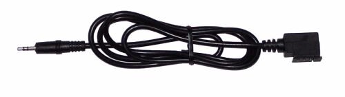
Connecting a handheld GPS Receiver to a PC or Pocket PC
Both Garmin and Magellan handheld GPS
Receivers ship with a cable that will connect it to a PC, but none of
them ship with a cable that will allow you to connect it to a PDA
(Palm or Pocket PC).
PC-Mobile supply a
cable set. The
cable should comprise of two parts, the first part is the cable that
screws onto the back of the Magellan like the one below.
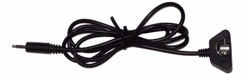
Magellan GPS Cable
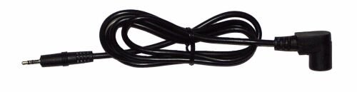
Garmin GPS II / III / V / 12 / 30 / 40 /
45 / 48 / 89 / 90 / GPS76 / StreetPilot / GPSMap
Garmin eTrex / eMap Cable
The second part of the cable will have a
3.5mm socket on one end which will connect with the 3.5mm plug (left)
and the other end of the cable will have a PDA connector. This
then allows you to use your favourite GPS Receiver on your favourite
PDA and utilise a whole host of other mapping products anything from
Topographical products like Fugawi, OziExplorer, Memory-Map to Street
Routing software like TomTom Navigator, PowerLOC Destinator and you
don't then need to purchase a second GPS Receiver if you're primary
use going forward will be on the Pocket PC! |
|
|
 |
 |
 |
 |
|
|